Research vessel Sharp towed it on July 9th 2010 in the middle of Chesapeake Bay and this is a part of my new research project: Life in the Dead Zone which is funded by National Science Foundation.
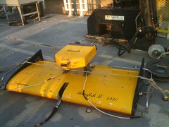
It literally flies up and down in the water column and is controlled by the computer package below:
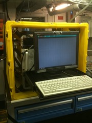
After 'scanning' the water I processed data with Sea-Bird Software which convert data into available numbers. Then, I used Surfer software to draw a following pictures.

X-axis is the latitude and y-axis is the depth of oxygen and salinity
Location:6, Hoopers Island,United States
No comments:
Post a Comment